.avif)
Lower Silesian magic, or a few words about the attractions of the Kłodzko Land
Table of contents

From the article you will learn:
- What to see in Kłodzko and why St. John's Bridge is “held”... eggs
- What attractions await in the Snow Maiden Massif: Bear Cave, Uranium Mine, Earth Museum and Limestone
- Where to discover the mining history of Złoty Stok and experience an aerial trekking in the Forest Park “Skalisko”
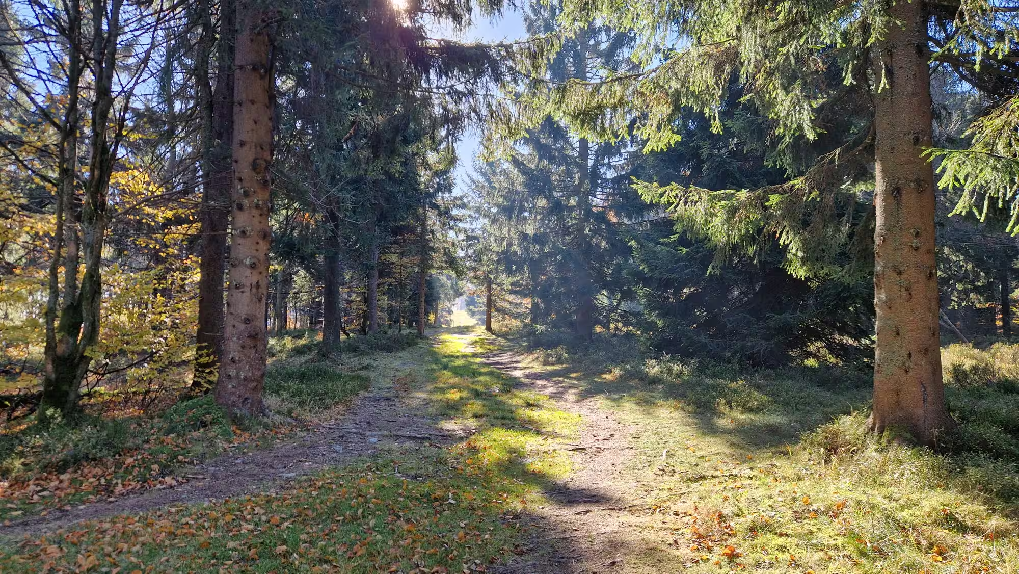
The Land of Kłodzko, until 1945 the German Glatzer Land, rightly called the “Land of the Lord of God” (Gottes Ländchen) is an area in the south-west of the country, in the Central Sudetenland and part of the East. A region with extraordinary tourist values, picturesquely located on the slopes of mountains inviting for short walks and long hikes, not only to the highest peak of the Kłodzko Region - Śnieżnik (1425 m above sea level).
However, attractive, though lower, are the peaks of the Bystrzyckie, Sowa and Bardzkie Mountains. Many cities and towns are united by a rich healing tradition, among them: Kudowa, Polanica, Duszniki, Lądek — all “Zdrój”. Other charming and worth visiting points on the map are, for example, Międzygórze, Bystrzyca Kłodzka and the regional capital, Kłodzko. It is impossible to name the majority. It is worth visiting here all year round, because even if it is winter in Kłodzko, it is a real “eldorado for skiers” with Zieleniec at the head. Most of the “magnets” in Kłodzko are available to tourists without seasonal restrictions. Sometimes the hours of sharing change, so depending on whether it is July or November, it is worth checking the details on the websites, in the information sheets, anyway.
Kłodzko — fortress and bridge with the addition of... eggs
Located in the center of the basin, it is the capital of the region and acts as a transport hub for transfers to the spas located nearby. The history of Kłodzko is more than 1000 years old. The first mentions of the settlement lying on the amber trail date back to the 9th century. The town received city rights in the 12th century and has since developed rapidly, becoming one of the most important cities in Silesia. Unfortunately, the strategic location, on the border of Poland and the Czech Republic, caused numerous battles in this area: first the Polish-Czech, then the Hussite Wars, the Thirty Years' War, which almost razed Kłodzko to the ground, and finally the Second World War, during which the famous Kłodzko fortress was a prison of the Abwehr and the Gestapo.
In 1390, the medieval Gothic bridge of St. John over the Młynówka River was built. It connected Sand Island with the Old Town. Due to its form, it is often compared to the famous Charles Bridge in Prague.Characteristic sculptures with figures of saints, placed on the stone railing of the bridge, are often photographed by tourists. Interestingly, the bridge survived intact the numerous floods so often affecting this area. Legend has it that it is thanks to the mortar with the addition of eggs. Built on a hill above the city center, the Main Fortress is a unique monument of military architecture, often compared to the Silver Mountain fortress. In the place where it is located, on Fortezna Góra, there was already a castle in the 10th century belonging to the Czech prince Sławnik, who was the father of St. Wojciech.
In connection with frequent raids in the 15th century, a fortified castle was built here, and after its destruction, a powerful and modern system of Austrian fortifications was built. The construction of the fortress began in the middle of the 17th century. Expanded over the years by Austrians and Prussians, it became one of the most powerful bastions of Prussian Silesia. Today's shape dates back to the end of the 18th century. It is the most valuable work of modern defensive architecture in Poland. Currently, a small part of the bastions and underground are available for sightseeing. The observation deck offers a magnificent view of Kłodzko and the surrounding area. The fortress with the bastions on Owcza Góra on the other bank of the Nyssa is the largest such object in Silesia. It covers an area of almost 20 ha. On the market stands the impressive Neo-Renaissance Town Hall, which was often destroyed and rebuilt.
Its current shape was given at the end of the 19th century. Next to the Town Hall there is a votive Marian figure erected in 1620 on a column, surrounded by saints. At the entrance to the town hall, a baroque fountain with a lion with two tails attracts attention. The town hall is surrounded by historic bourgeois tenements from the 17th and 8th centuries. The monumental church of the Assumption of the Blessed Virgin Mary and the monastery and church of the Franciscans are monuments of medieval sacred art.
The 500 m Underground Tourist Route named after the Millennium of the Polish State, which was created during the works to protect the Old Town of Kłodzko from collapse, which was threatened by the action of groundwater, as well as due to the poor condition of the foundations, is interesting for the “grottolazers”. It was created as a result of the work of the team of the Academy of Mining and Metallurgy in Krakow and includes a selected series of underground excavations, corridors and cellars dug in medieval times by the inhabitants of the city under the houses of the old town - both as shelters and storages.In the former Jesuit dormitory, the Museum of the Kłodzko Land was established. In the baroque building, it is worth seeing the most interesting interiors, such as a library, a two-storey concert hall with a dome, or the Golden Hall. The collection of the museum includes, among others, a collection of Silesian clocks from the period of industrialization in Lower Silesia, a collection of tin, a collection of numismatics, as well as unique glass.
SNOWFLAKE MASSIF AND KLETNO
Kletno, is a charming village located in the deep Kleśnica Valley at the foot of Śnieżnik — the highest peak of the Eastern Sudetenland. It is by far the best starting point for hiking, cycling and skiing trails in the Śnieżnika Massif. Hiking trails lead here through the almost virgin areas of the landscape park, where you can come across a herd of deer or deer. It is a village that has a rich accommodation and catering base. It is best known for Bear Cave. Those who are interested in geology can tell you that Kletno is “a mecca of cavers and stone collectors”.
URANIUM MINE
It is located on the northern slope of Żmijowiec in the Śnieżnika Massif. It operated between 1948 and 1953, using, among others, several medieval mills, where iron, silver and copper mining were carried out in the past. The mine included 20 shafts, 3 shafts, and the total length of all mining workings was more than 37 km. In total, 20 tons of uranium were mined here. Open to visitors, the mill No. 18 is located on the road connecting Kletno and Sienna. It consists of a separate excavation system located in the northeastern, highest part of the mine. Here you can see many attractively illuminated occurrences of local minerals (fluorite, amethyst, quartz and others). The length of the available excavations is about 400 m of sidewalks with a width of 1.5-2 m, a height of 1.7 to more than 2 m.
BEAR CAVE
It is the longest of the Sudeten caves and one of the longest and deepest in Poland. The cave is developed horizontally on three levels. The known length of the halls and corridors is more than 3 km, while the depth is about 60 m. The upper level is preserved in ruins. On the middle level there is an extremely attractive tourist route with a unique and well-preserved infiltration cloak of the cave and a large number of bones of animals of the Ice Age. The lower parts are inaccessible to tourists. The formation of the Bear Cave is closely associated with the occurrence of carbonate rocks. The marbles that are part of the geological construction of the Sneznik Massif are of the Precambrian age (about 600 million years).
At the foot of the Bear Cave, the Kleśnica stream buzzes. It is to the waters of this stream that we owe in large part the sculpting of the Bear Cave. During the glaciations, deposits rich in the remains of animals living at that time were formed in the cave. The largest amounts of remains belong to the cave bear (Ursus Spelaelus), hence the cave got its name. Bones of a cave lion, cave hyena, wolf, bison, marten, bats (several species), beaver, roe deer, wild boar, fox and many rodents were also found in it. The origin of these remains varies. These are the bones of animals that inhabit the cave, prey of predators, or, finally, bones deposited here by water.
Bear Cave is unique in many ways. Tourists are especially impressed by the diverse and well-preserved infiltration mantle of the cave. The most famous infiltrations are stalactites hanging from the ceiling along with thin noodles. To meet stalactites, squat stalagmites often come out from below. When a stalagmite comes into contact with a stalactite, a stalagnate is formed, or an infiltration column... Bear Cave boasts an exceptionally rich infiltration robe of the bottom of the cave. These are necrotic bowls filled with water, calcite hedgehogs form at their bottom, calcite flowers crystallizing on the surface of the water in bowls, forms similar to coral reef, rice fields or cauliflowers.
LIMESTONE GRACIOUS STONE IN OLD MORAVIA
It is the only restored Rumford-type limestone tower based on the design of K.F. Schinkl in Poland. Related objects are located in Germany, in Maxen near Dresden and Rüdersdorf near Berlin (they were exhibited at the EXPO 2000 World Exhibition in Hannover). In itself, it is a fascinating monument of technology, its construction allowed permanent use differently than in the case of conventional limestone. At Wapiennik Łaskawy Kamień there is an Author's Gallery of the Rybczyński Family, artistic printing and paper drawing studios, a Japanese garden. The tour of the site, the park enclave and the Japanese garden accompanied by a guide takes about 60 - 90 minutes.
MUSEUM IN KLETNO
The Earth Museum in Kletno has a unique collection of minerals and fossils on the scale of Poland and Europe. Specimens come from all over the world. Rare finds include four fossilized nests with dinosaur eggs - more than forty eggs in total. In our country, this is the only place where we can admire these unique fossils. Visiting the museum is always carried out with a guide. The property also features a garden and a Jurassic Park.
In addition, among the exhibits: tracks of mammalian reptiles from 250 million years ago - the best preserved tracks in Europe, traces of dinosaur paws from the Table Mountains - some of the first found in this area, a collection of fossilized teeth of dinosaurs and mammoths, a collection of fossilized marine mollusks (the largest ammonites in the world found in Morocco), tree trunks and preserves traces of flora from 250 million years ago, the largest rose quartz brushes found in Europe (from the Jizera Mountains), iron-nickel meteorite, gypsum crystals from copper mines, collection of agates from all over of the world, including the largest agate found in our country, a collection of striped flints from the Świętokrzyskie Mountains, mineralogical curiosities such as: opals, staurolite, okenite, ulexite, various types and forms of quartz, ore minerals, precious and ornamental stones from all over the world.In Jurassic Park we will meet, among others: of the dinosaurs made on a scale of 1:1, the site of primitive man, the fossilized Permian forest, decorative rockeries with mountain plants around the Jurassic Park, wonderful attractions for children and adults.
GOLD MINE IN THE GOLDEN SLOPE
The oldest mining works were carried out in the vicinity of Złoty Stok as early as 2000 BC. From then until the present years, more than 300 km of grooves, shafts and walkways distributed on as many as 21 levels.The first record of mining works carried out here dates back to 1273. The greatest boom in gold mining occurred in Złoty Ste At the beginning of the 16th century, in 1507, the princely mint was moved here from Ząbkowice Silesia and gold ducats began to be minted. This brought an increase in the city's rank and tangible financial benefits. In the second decade of the 16th century, European mining and metallurgical companies began to invest here. At that time, from its nearly 200 mines, the Złoty Stok supplied about 8% of all European gold production.
However, the intensive development of mining was not followed by equally intensive technical progress, and the robbery economy and maximum profit orientation led to many tragic mining disasters. One of the largest was the collapse of the main shaft in the “Golden Donkey” quarry, 72 m deep. 59 miners died. The infarction was never removed and neither were the remains of the victims found. The tragedy of the “Golden Donkey” was the beginning of a bad streak that led to the withdrawal of the Fugger company from further investments in Złoty Stok.
It should be mentioned here that gold from the Golden Slope has a significant share in the history of the world. The Fuggers supported Queen Isabella of Spain with their gold, who was able to finance the expedition of Christopher Columbus, which ended with the discovery of America.Fame was brought to the Złotostok mines by the world's first shot of rocks with black gunpowder (1612). The bad streak, however, continued for years to come. Numerous mining disasters, fires and pestilences, the largest of which claimed 1,100 victims, significantly ruined the town. After the destruction of the Thirty Years' War (1618-1648), the city was already on the verge of collapse.
The breakthrough was brought only by the settlement in the Golden Slope of Hans Schärffenberg - an apothecary and alchemist. After many experiments, he managed to develop a process for recovering arsenic from arsenic ores. For more than 100 years, Złoty Stok has become the world's leading supplier of arsenic. The short-sighted policies of Schärffenberg's descendants, however, led to the depletion of ore reserves and the collapse of mines and steelworks. Gold mining was not reactivated until after the Prussian-Austrian wars. In 1848, a cheaper method of producing gold was developed, which consisted of chlorinating roasted ore and leaching pure metal from chloride compounds. This method was used in the Golden Slope by Wilhelm Güttler, who, after processing all the raw material, bought all the mining areas in 1883. This property was maintained by his heirs until 1945. Thanks to their efforts, in 1900 a railway was built connecting Złoty Stok with Kamieniec Ząbkowicki, which undoubtedly contributed to the significant industrial development of the city. His heirs maintained this property until 1945. During their reign, many technical innovations were introduced, among them the electric railway, transporting the workpiece, which today is available for visiting the “Gertrude” mill.
The activities of the Second World War did not bring any damage to the mine, and after its end, the Germans handed over the whole to the Polish authorities intact. The work in the mine was undertaken by miners, brought here from Upper Silesia. A German employee still worked in the laboratory for some time, who trained new users in the correct operation of the equipment. In 1948, the search for new deposits began. In 1962, due to unexplained reasons, the mining and metallurgical activities in Złoty Stok were terminated by a “top-down order”. This decision raises serious doubts, since the mine produced an annual yield of 20-30 kg of gold, only in 1961 it fell suddenly, for unexplained reasons, to 7 kg. Due to the natural circulation of water, which was no longer pumped out, the mine was completely submerged in a short time. Over the entire mining period, i.e. over 700 years, about 16 tons of pure gold were mined in Złoty Stok.
The mine “stood” for 35 years. In the end, it was decided that some corridors should be opened up and made available for tourist traffic. The main originator and implementer of the project was the then mayor of Złoty Stok, Wiktor Lubieniecki. After 5 years of work, the Underground Tourist Route “Gold Mine” was launched on May 28, 1996. So far, we have managed to make extremely interesting quarries available: Sztolnia “Gertuda”, Sztolnia “Czarna Górna” with the only underground waterfall in Poland (8 m high) and the latest section, made available for visiting since 2008, “Czarna Dolna” Sztolnia. Gold mining in Złoty Stok is still waiting for its explorers.
Explorers may come across many remnants of past centuries, ranging from the remains of miners who once worked here, who were never excavated after mining disasters, to the secrets of the Third Reich meticulously hidden from prying eyes by rock falls.
FOREST NATURE PARK “SKALISKO”
It was established in Złoty Stok in 2006. The location in the Kłodzko Valley, within the Śnieżnica Landscape Park, includes forest areas and the area of a former quarry. Between heaven and earth, in the beautiful forest on the Golden Stream, on an area of more than 7 hectares, there are attractions that provide the power of a unique experience. This is a unique type of aerial trekking, which is based on acrobatic passages between trees such as: balancing bridges, rope crossings, net crossings, aerial surfing, Tarzan jump, zip-lines - descents on ropes with a total length of 1050 meters and many others.
Participants overcome the prepared route on their own. The degree of difficulty of the individual sections varies, from very easy and gradually increases. Installations that are too difficult can be skipped. A special route for children has been set aside in the Park. Everyone will find here something for themselves according to their strengths and capabilities. People using the attractions of the Park receive personal equipment and undergo mandatory training in the field of movement along the route. In the process of passing through the installations, each of the participants is tied to a special rope (called a “lifeline”), which guarantees to avoid falling from a height. Our instructors supervise the movement of participants on the routes and are always there to help if necessary.
TABLE MOUNTAINS
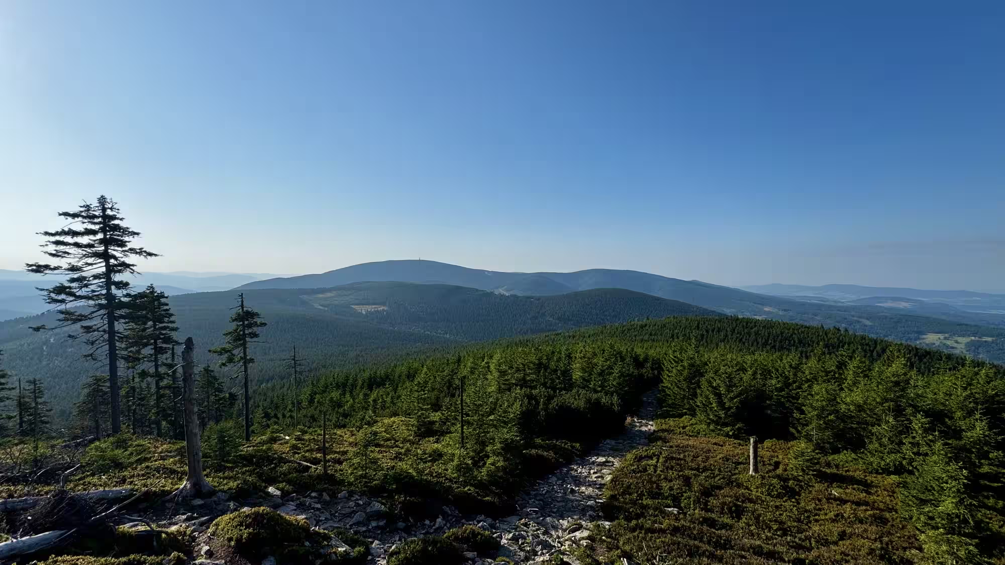
The Table Mountains National Park was created on 16.09.1993. It is located in the Central Sudetenland in the north-western part of Kłodzko Region, near the Polish-Czech border. Table Mountains is a vast sandstone slab located on the territory of Poland that fills the South-South basin, between the Giant Mountains and the Bystrzycki and Orlicki Mountains. The Czech fragment is called Broumovska Vrchovina and is also protected (CHKO -Broumovsko). The Table Mountains close the Kłodzka Valley from the north-west, stretching for 17 km in a southeasterly direction: from the Polish-Czech border to the breakthrough Bystrzyca Dusznicka valley in the vicinity of Polanica Zdrój. Table Mountains National Park is crossed by the extremely picturesque “Road of One Hundred Curves” at any time of the year. The road is the main transport artery of the park. Breaking through the Table Mountains, it connects Kudowa Zdrój and Radków lying on opposite sides of the massif of the city. The park covers an area of approx. 63 km2 with the highest elevations; Szczeliniec Wielki (919 m above sea level) and Skalniak (915 m above sea level).
The Table Mountains are a very attractive and well-developed area for tourism. The Park area is crossed by a dense network of hiking trails (with a total length of approx. 100 km), including a section of the main Sudeten trail named after M. Orłowicz. They provide all the rock peculiarities of the massif: magnificent “rock town” on Szczelińiec Wielki (919 m above sea level), the highest peak of the Table Mountains, the rocky labyrinths of Błędne Skał in the Skalniak massif (915 m above sea level), Skalne Grzyby and Radkowskie Skały, beautiful Puchacz Rocks, located in the landscape reminiscent of the Łężyckie Skałki savanna. In the Table Mountains, fantastic rock forms are found not only on Szczelińiec Wielki and Mały and in Błędne Skały. They can also be found in the area of the so-called Skalny Grzybos (north-eastern part of the PNGS), Radkowskie Skał (at Szosa Stu Zakręty) or in the vicinity of the White Rocks located at Narożnik. These places are less known and less often visited by tourists, which makes them very attractive for those who value contact with nature. Near the hiking trails there are car parks and places for rest. The southern end of the area is the international road E - 67 from Prague via Wrocław to Warsaw. Road border crossings between the Czech Republic and Poland are located in Kudowa Słonem and Tłumaczów. A unique attraction is the mentioned “Road of One Hundred Curves” running from Kudowa Zdrój via Karłów to Radkow. Karłów is the best starting point in the most attractive part of the Table Mountains to Szczeliniec Wielki and to Błędne Skał.
SILESIAN JERUSALEM
By this term they are called Wambierzyce, a village near Radków, in the vicinity of the Table Mountains National Park. At the beginning of the 18th century, on the site of a wooden chapel from 1263, the church of the Visitation of the Blessed Virgin Mary was built in Wambierzyce, with baroque architecture (cloisters around the oval nave, 11 chapels). The construction of a Marian shrine in the town is connected with the 12th century message, according to which the blind John of Ratna (Ratno — a village 2.5 km from Wambierzyce, 1 km from Radkow) was to regain his sight in this place, and the figure of the Mother of God was to appear to his eyes. In the interior of the monumental temple there is, among others, a sculpture made of linden wood of the Virgin Queen of Families, dating from the 14th century (other sources indicate the 13th century) crowned in 1980. In 1936, the church was given the title of a minor basilica. In 1945, the village was included in the borders of Poland, and the inhabitants of that time were deported to Germany. The temple towers above the market, from which 57 stairs of symbolic significance lead to it: 9 (the number of angelic choirs) + 33 (the age of Christ at the time of the crucifixion) + 15 (the age of Mary at the time of the conception of Christ). In addition, in the period from the end of the 17th to the 19th century, a calvary with about 100 chapels and shrines and 12 gates was built in Wambierzyce, on the initiative of Daniel von Osterberg, the owner of Wambierzyce at that time. The stream flowing through the town is called Cedron, the names of the surrounding hills refer to biblical themes (Tabor, Zion, Horeb, etc.). This refers in its symbolism to the Jerusalem of the time of Christ. In 1882, a movable nativity scene with more than 800 figurines was made in the village by the local watchmaker Longinus Wittig.
Kłodzko Land - a special land. Visiting it can take many beautiful days, and still a lot remains to be discovered. After all, apart from the obvious things, which have been described in part above, this land is full of flavors, mysteries and unobviousness, which each of us, at his own discretion, can know.